

- About Our District
- About Geumjeong-gu
- Guide to Geumjeong
- Characteristics
Characteristics
Geumjeong-gu’s Characteristics
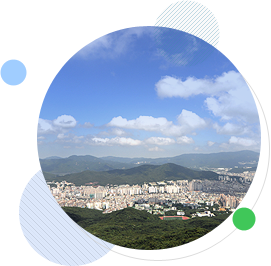
- Located in the northernmost district of Busan, Geumjeong-gu is a gateway to ground traffic going to and from neighboring metro districts Buk-gu, Dongnae-gu, Haeundae-gu, and Gijang-gun.It borders on external districts Yangsan-si in Gyengsangnam-do, and thus serves as an approach to downtown areas as well as the starting point and last stop of the Gyeongbu Expressway, Busan-Ulsan National Route 7, the industrial roads, and the urban railways.
- Located in Mt. Geumjeongsan (801.5 meters), 1.5-1.6-meter-high Geumjeongsanseong Fortressis Korea’s largest fortress running 17 kilometers long with an inside area of 8.2 square meters. Beomeosa Temple, one of the nation’s five top temples, is in the vicinity of the fortress, along with Sanseong Village, which serves folk dishes and lends a place for resting.
- Moreover, golf clubs such as Busan Country Club ad Dongnae Benest Golf Club, and Pusan National University are in this area. Guseo and Namsan are in the limelight as comfortable residential areas. Speaking of industrial facilities, there is the Geumsa Industrial Complex for SMEs.
Extensive area of rapidly growing population
Most of residential areas have formed between Hoedong Reservoir in the east and Mt. Geumjeongsan in the northwest, so this vast District stretches out 65.12 square kilometers, taking up 12.3% of the total area of Busan. Because of the construction of large-scale apartment complexes and housing developments in the districts (dongs) of Bugok, Jangjeon, Namsan, Guseo, and Cheongnyong, Geumjeong-gu’s population has been rapidly increasing.
Extensive urban-rural complex with restrictions on private rights
The total area of greenbelt zones and water source protection zones is 39.24 square kilometers, taking up 63% of the district (Geumjeong-gu), which means private rights are restricted in extensive areas. Among 17 dongs (administrative sections), five are rural sections. That is,this District is an urban and rural complex with diverse administrative demands and residents’ high desire for potential growth.
Key position of ground traffic
As a gateway to Busan, it functions as a contact point of ground transportation and is a main traffic hub as the starting point of the Gyeongbu Expressway, the urban expressway, industrial roads, and metro rail Line 1.
Cultural and tourist town
Located in Mt. Geumjeongsan, Beomeosa Temple, one of the five top temples in Korea, has plenty of state-designated and local cultural properties. A group of wisterias (Natural Monument No.176) create a picturesque landscape in harmony with the dense temple forest as a backdrop. Also, this temple has been a popular attraction in Busan along with Geumjeongsanseong Fortress.
Geographical Features
Mountains
The mountainous area in Geumjeong-gu basically lies at the terminus of the Taebaek Mountains. This end of the Taebaeks was divided near Pohang into the Eonyang Fault, the Yangsan Fault, and the Ulsan Fault through a series of northeast-southwest trending fault movements in the Miocene Epoch. In Busan, the fault runs into the Korea Strait at a reduced altitude.
With respect to the three-branched mountainous areas, the first one is the Geumjeong Mountains, running from Wonhyosan in Yangsan to Geumjeongsan (801m), Sangyebong Peak (638m), Baekyangsan (642m), Gowongyeonsan (504m), Gudeoksan (562m), Siyaksan (590m), and then Seunghaksan (495m). Another is the Geumryeon Mountains, running from Daleumsan (586m) in Ilgwang-myeon, Yangsan-gun to Jangsan (634m), Geumryeonsan (415m), Hwangryeongsan (427m), and then Bongnaesan in Yeongdo Island. The other is the Sineo Mountains, running from Togoksan (855m) in Wondong-myeon, Yangsan-gun to Sineosan (630m) in Gimhae, Gyebong Peak (393m), Yungjibong Peak (750m), Bulmosan (802m), Bogaesan (479m), and then Yeondaebong Peak (495m) in Gadeokdo Island.
Geological features
The north-south long, fine-grained granite zone lies from Bugok-dong to Dugu-dong in Geumjeong-gu.
The intrusion of this granite body comprised of the above mountainous prongs into andesite, rhyodacite, and biotite granite is found. The gradual movement can be spotted. Specifically, the grain sizes get bigger as the amount of pinkish feldspar from andesite to biotite granite lessens. This is a pinkish fine-grained rock composed of halite, potash feldspar, a small amount of plagioclase and biotite with grains of iron ore. The structure is allotriomorphic granular with the graphic texture of halite and feldspar. The body of biotite granite is distributed in Jangjeon-dong.
Central flatland
Located in the northern part of the Dugu-dong-Dongnae flatland located of the Ulsan Fault, the upper stream of Suyeongcheon Stream is mainly comprised of farmland, thus used for crop cultivation.
River
Suyeonggang River
The 30-kilometer-long Suyeonggang River is the second longest river following the Nakdonggang River. Originating in Mt. Wonhyosan in Yangsan, this river runs to Jaesong-dong in Haeundae-gu through the Hoedong Reservoir, and finally flows into the Suyeong Bay after joining the Oncheoncheon Stream originating in Mt. Geumjeongsan.
In its upper stream is the Hoedong Reservoir, the source of drinking water for Busan people. The sewage treatment plant is situated in the river to preserve the quality of water in the Suyeong Bay Yachting Center.